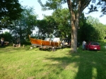
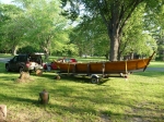
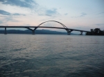
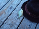
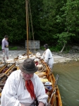
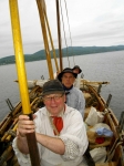
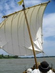
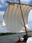
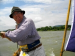
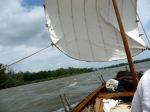
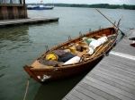
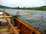
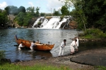
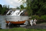
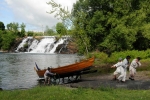
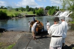
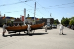
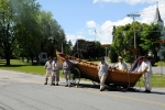
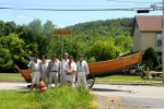
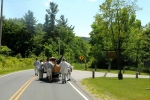
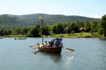
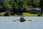
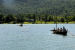
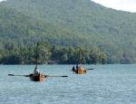
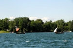
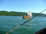
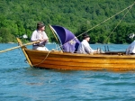
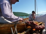
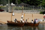
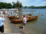
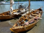
Also known as ‘The Big Row, 2012’
Photos were taken by Bill Westervelt, Bill Manthey, Kevin Richard-Morrow, and Heather Manthey. Video was taken by Heather Manthey. The photographs and videos are copyright by the person who took them. Text is by myself, David Manthey.
- Historical References – mainly from de Bougainville, regarding portaging, bateaux, and Bolton Landing
Monday, 11 June 2012 – Crown Point Campground
This is the beginning of this year’s Big Row. This year seems to have been much more work to plan than previous years, for a host of reasons.
This year is something novel — a portage. I’ve wanted to do a portage for quite a while, as this was a common action with bateaux. Several years ago I contemplated building a 4-wheeled wagon for a portage, something like a hay-cart. However, I don’t know enough about swingletrees, pivoting axletrees, or harnessing oxen, and I failed to do more than imagine the process.
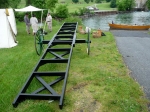
Last fall, after Hurricane Irene washed out Lock 8, we needed to get the boats out of the mud river bank, and no easy solution presented itself. This motivated me to build a 2-wheeled wagon like French tidal boat carts, and we extracted the boats from the deep mud using it (see my write-up here).
We now have a period-inspired (if not quite correct) wagon, and, as such, the means to do a portage. The shortest reasonable portage I could find that coincided with a reenactment is the Ticonderoga portage from Lake Champlain to Lake George.
In addition to the complexity of adding a portage to the rowing trip, I have also been busy finishing up a new lug sail. Back in 2004 I sewed a square sail entirely by hand. Kevin has been urging me to make a lug sail, since the documentation I have is mixed between square and lug, and we could learn from having one of each.
This spring, Kim, Kevin, and I used a sewing machine to sew the fabric panels together. The rowing group had some sewing meetings to sew grommets. I finished sewing the bolt rope some time ago, but still had some of the reef grommets and the reef cringles left to do. In the last week and a half, I finished the sail, including making a new ash yard and all of the various lines for the sail.
As a third project, this year’s Big Row will end at the reenactment at Bolton Landing. Historically, the French army in 1757 sent 2/3 of its force by bateaux and 1/3 by land and met at or near what is now Bolton Landing. Of the bateaux, 115 contained artillery, and, of these, 62 bateaux were formed into 31 pontoons to carry heavier cannon.
I would like to fasten our two bateaux into a pontoon and try this out. To this end, I have obtained some rough-cut lumber of appropriate dimensions.
An additional complexity for the rowing trip is that we are not allowed to camp at the New York Department of Fisheries boat launches, which would have been the convenient stopping places. Instead, our first day gets to be somewhat long, and I fear for our abilities to row so far if the wind is contrary.
Furthermore, the boat launches at Crown Point and Chimney Point have been impacted by the construction of the new Champlain Bridge. A few months ago it looked like neither launch was open, but as of a few weeks ago Chimney Point is open and being used.
Lastly, the crew schedule is complicated. I have a total of nine people who want to row, but the sequence is such that we will start with one boat and five people, then add the second boat after the portage.
I loaded the bateau wagon and all of the necessary gear into my car, then drove to the Mabee Farm. Kevin arrived in short order and hooked up the Bobbie G and the regular boat trailer to his Jeep. The DeSager will be brought up by Rick on Wednesday morning on the flat-bed trailer along with some boards for the pontoon project.
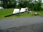
Kevin and I convoyed up to Ticonderoga. Here we dropped off my car, leaving it in an allowed parking space not far from where we hope to camp on Tuesday night. The bateau wagon forms a strange pile on top of the car, with the wheels in the back seat. Although we could carry the wagon in the boat, it would be awkward.
I join Kevin in his Jeep, and we continued up to Crown Point campground. We arrived a little after 4 in the afternoon. The entrance gate was unmanned, and we proceeded to our reserved campsite.
We had just erected a tent when Reb and Bill M. arrived from New Hampshire. They had stopped at a fishing supply store and purchased some bait, as Bill hopes to fish on this trip.
I had vaguely hoped that the shore along the campground would be friendly enough that we could launch the boat this evening and load it on the shore. Although this would have been possible, it was more work than trailering it in the morning. We tried to pack as much as possible in the evening so as to have as little as possible to do in the morning.
Unfortunately, the cell phone access here is not very good and very carrier dependent. One would hope that the various carriers would actually roam on to the other networks, but this is not the case, and only Reb has decent access. This would be an issue through the trip affecting contact with rowers who were coming and going. There is an irony that we rely so heavily on modern communications to recreate the 18th century.
After dinner, Bill and Reb went fishing off the pier. They caught one small fish.
Tuesday, 12 June 2012 – Crown Point to Bicentennial Park, Ticonderoga
This morning dawned with the promise of strong southerly winds, our least desirable weather condition short of lightning. We ate breakfast, packed up, and waited for a fifth rower. Our potential rower had tried to contact me and let me know he couldn’t make it, but I didn’t get the message until later.
We trailered the boat across the bridge to Chimney Point, leaving Reb to wait for our additional rower. The wind freshened. Eventually Reb came over, and we launched and started rowing.
Wind. We were under way a little before 9 a.m., and the wind was not too bad yet. However, the wind continued to freshen. We rowed into the wind. We traded off who was steering and rowed into the wind. We watched the shore barely move. We rowed into the wind.
As with all strong headwinds, we barely dared to take the slightest break as doing so lost way. We rowed into the wind. I feared that the trip was in trouble and we had barely started. We rowed into the wind.
I knew that the town of Crown Point has a boat ramp that was around five miles from our starting point. I figured that if the wind continued at this strength, we would have to take out at that boat launch and trailer the boat ahead. I don’t like doing this — it feels like cheating. Yet, since we have the portage scheduled for Wednesday, and it has been announced in the newspaper (the Times of Ti), I feel we have to be there.
After two hours of rowing into the wind, we neared a small hook of land on the west shore. I estimated we had gone 2.5 miles (though later, measuring off of the chart suggested it was a slight bit longer than this). We landed on a beach near a strange object. We couldn’t decide if the item was a pump house or something else. We needed the break.
Sitting in the comfort of one’s home, two hours of strong effort doesn’t seem like much. At the time, we were somewhat tired, but, even more, we dreaded another 8 hours of such effort, knowing that we probably couldn’t maintain the effort, and that it would turn into 12 hours or more.
Reb suggested that, rather than continue to fight into the wind for another 3 miles to the next boat launch, then spend some vexing effort trying to get a ride to get the boat trailer, we could, instead, turn around and sail back the way we came, heading right back to Chimney Point. From there, we could easily put the boat on the trailer and forward ourselves to the boat ramp at Ticonderoga Ferry. This would leave us four miles to row, two of which should be sheltered from the wind.
We’ve proven that we could take the hard road in the past, and felt that we would go for the sensible option in this case. After a decent break, we got back in the boat.
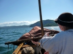
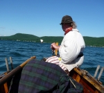
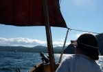
We rigged out the lug sail. It took longer than rigging out the square sail, as we weren’t as familiar with it. Reb handled the halyard and the whisker boom, Bill and Kevin handled the sheets, and I steered.
Once we got out of the comparative wind shadow of the hook of land, the Bobbie G took off. The water positively boiled from under our stern. As the saying goes, we had a bone in our teeth and were leaving a definite wake. The steering was hard but I never felt that I was lacking control.
The sail was exhilarating. In 20 minutes we were back under Champlain Bridge. We have never gone so fast for any distance. The new sail performed magnificently, though it was at least as much due to the strong wind than to anything else.
We loaded the boat back on to the trailer, then drove to the boat launch at Ticonderoga ferry. The drive seemed weirdly slow and somewhat surreal after the sailing, even though we were going faster.
We relaunched at the Ticonderoga boat ramp. While we were doing so, some people saw us who had heard about the trip from the local paper. We told them about the wind and our change in plans to stay on schedule. Shortly after we put out, we served out a pleasant lunch.
The wind wasn’t as bad immediately off the boat ramp as the lake makes a bit of a dogleg around Ticonderoga and forms a relative windbreak. Once we got past the first point of land, the wind strengthened, and then, after the next point, strengthened some more.
As we came by Fort Ticonderoga, we had changed our course to head toward La Chute, and the beam wind and sea was lumpy and uncomfortable. Still, this was easier than rowing directly into the wind.
We saw the Fort Ticonderoga bateau, built by Dale Henry. It had the strangest objects for thole pins — they looked like untrimmed trunnels or perhaps 2×2 dimensional lumber that had been whittled to fit into the chocks. A strange jarring accent to an otherwise handsome craft.
Between the lake in front of Fort Ticonderoga and La Chute there is a reedy area. This swath of reeds extends for a good half mile or more separating the channel of La Chute from the lake proper. There is a small passage between the two near the Fort, and this passage substantially reduces the distance that we needed to travel.
Heather and I had canoed the area just two weeks previously, and I knew that the passage was clear and plenty deep. What I hadn’t counted on was that the wind from the south was driving water up La Chute, and that this, plus the water coming down from Lake George, was flowing out of the small passage.
As we rowed through some weeds and into the passage, several of us felt like we had run aground. The bateau seemed to be stuck fast. However, Reb plunged her oar into the water and found no bottom. We were not aground; we were impeded by a strong current that formed a visible fall of water through the passage. We muscled through, with Reb pulling one of her stand-and-row brute force efforts.
Once into the La Chute channel, the reeds formed a wind break from the east, and the southern exposure started pushing us in our desired direction to the north. The rowers rested on their oars, and we drifted gradually upstream.
La Chute forms an interesting, twisty channel. There are some false channels and dead ends, plus lots of blow-down that can snare a boat. However, I was familiar with the channel, and it wasn’t an issue. At times the area looked almost untouched, and then, a moment later, we would happen upon a piece of trash or a collection of debris, ruining the illusion.
We drifted very slowly until we reached the railroad bridge, then rowed unhurriedly up La Chute. We passed under the Route 22 bridge. I expected to encounter a snag that we would have to squeeze through, but sometime in the last two weeks half of it had washed away, and the area was clear rowing. We only had to take in oars briefly to get around one tree, and at no time did we need to duck to get under anything.
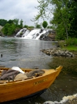
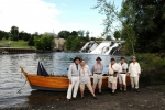
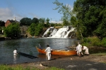
Up past the water treatment plant, under the covered foot bridge, and the end of the day’s trip was in sight. The lower falls roared, and the old paved boat ramp beckoned. We pulled into the shore.
Although we had only rowed and sailed a total of around 9 miles compared to our original plan of 17 miles, we had still done a vigorous day’s work. In the 18th century they would have sat out the head winds. Since we had a schedule to keep, we could not afford this luxury. We made the right decision, even if it vexed me to do so.
We gradually set up camp in the lovely Bicentennial Park. We talked with a few passersby, some of whom had seen the article about us in The Times of Ti. It started to rain, and then rained heavily. We rigged an awning which, though it leaked, was better than nothing.
I retrieved and assembled the boat wagon in preparation for tomorrow.
Tonya, the town clerk, stopped by and greeted us. She had helped greatly in arranging permission for us to camp in the park and get some publicity. She also arranged so that we had access to the restroom for the evening, and therefore did not have to hike the further distance to the portajohns at the baseball field.
Kevin made a lovely beef heart stew for dinner.
We turned in fairly early, tired from the wind and the effort of the day.
Wednesday, 13 June 2012 – Ticonderoga to Rogers Rock Campground
We were up early, partly because we had gone to bed early and partly just because it was light out. We had a breakfast of eggs and sausage, then gradually packed up camp.
I had been telling people that the portage would get under way around 10 a.m., though we might take the boat out starting around 9. This made for a lazy morning.
Reb and I walked the first part of the portage route and discussed safety and strategy. As always, I value her opinion above all others on efficient and safe manual labor.
Sometime between 8 and 9, Sam Willis arrived on foot. Yesterday, Heather had picked him up at the Albany airport and then brought him to Ticonderoga. He had declined to spend the night with us in the town park, and instead had opted for a local hotel.
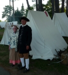
Although I had conversed with Sam via email over the past several months, it was the first time I physically met him. He is younger than I expected, good-natured, and willing to go along with our eccentricities. We gave him some 18th century clothing to wear.
Rick arrived with the DeSager on the second trailer. Heather also arrived to help with logistics and to take some video footage of the portage. We decided to move vehicles to the Mossy Point boat launch before we did other things. Rick and I drove our vehicles over, and Heather gave us a ride back.
We had piled up all of our gear alongside the area where the boat would come out. We would take the boat out of the water with it mostly, then add back in our gear for the portage.
While we were organizing things, Bill Westervelt showed up. He is a Ticonderoga resident, photographer, and long-time reenactor. He ended up accompanying us throughout the day, taking pictures, keeping us safe on the road, and helping us out in all ways but hauling things.
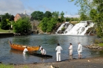
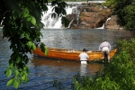
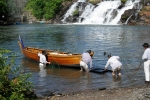
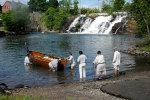
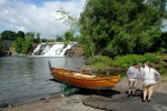
I rigged a line on either end of the wagon and made sure everyone was ready. We pushed the Bobbie G out from shore to give enough space at the bottom of the ramp for the wagon, then pushed the wagon into the water.
The first surprise was how high up the wagon floated. The wagon is mostly wood. It has a stout white oak axletree with white pine rails and cross members. The axletree has a heavy square iron pipe embedded in it, into which goes the steel axle. Add to this the iron-shod wheels, and the whole thing probably weighs between 150 and 200 pounds. Despite the significant quantity of wood, I expected that the rails would be nearly under water from supporting the various metal parts. Rather, they floated quite high, and the wheels lost contact with the bottom quite soon.
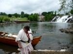
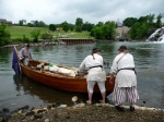
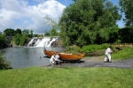
Several of us waded into La Chute, and I pulled the boat on to the wagon. It came very easily. We were able to depress the wagon into the water through the simple expedient of standing on it. The ladder-like cross pieces on the wagon allowed the boat to come onto the wagon smoothly without catching on the rails.
When we had used the wagon in the mud, it had been all we could do to wrestle the boat on to it. Getting it on to the wagon in the water was trivial.
Our initial position was too far forward, and after an aborted attempt at trying to pull the wagon and boat out of the water, we pushed in to deeper water and repositioned it. We also tied the bow and stern to the wagon with the mooring lines.
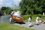
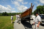
We now pulled the wagon out of the water, manually walking the wheels up over rocks and odd lumps of broken pavement. The spokes of the wheels can be used as hand levers, and the whole affair moves without undue effort.
Each time we stopped for any reason, we chocked the wheels of the wagon. I had made up two curved wheel chocks. These were simply two pieces of 2×6 that I had screwed together and cut on a bandsaw. I then attached a length of 1/4″ rope so that we could pick them up easily. It turned out that I should have added longer ropes; we extended them so we could attach them to the thole pins on the boat.
Reb and Kevin were concerned about how the wagon’s wheels looked. Indeed, one of them no longer had a consistent dish. That is, the wheels started with a uniform dish to their spokes, with the rim of the wheel a few inches outboard of the hub. I know that one of the wheels was somewhat alarming looking at the end of the mud portage, and I didn’t think they were any worse.
Still, Reb convinced us that we should not load all of the gear back into the Bobbie G, and that, in the 18th century, they wouldn’t have loaded up the boat either. They would have moved the gear via a wagon. Based on the rest of the day, this was prudent. We did not want to end up with a broken wheel halfway along the portage.
Heather took Rick back to Mossy Point in her car. Rick returned with the DeSager on the flatbed boat trailer. We put most of our gear in the DeSager, leaving only that which we would need on the portage. Rick then drove back to Mossy Point, and Heather returned him to us in the park.
We were now ready to begin the portage in earnest. I gave a brief safety talk. Everyone can ask us to stop; I value people above objects, and would rather have a destroyed boat than an injured person; don’t overdo it.
The first 200 feet weren’t too bad. We went up a slight incline on the pavement. Bill M. and Kevin started on the lead ropes, with Reb and myself on the wheels, and Rick and Sam pushing. We paused a few times.
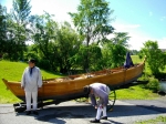
The next 200 feet were probably the hardest. We still had the boat balanced too far forward on the wagon. The nose of the wagon rubbed on the ground, and we sanded off a corner on the pavement. After stopping, we shifted some of the oars within the boat and got it into better trim.
It turns out that the people on the lead ropes don’t steer, even though they influence the direction of the wagon. The people on the wheels can steer, but really shouldn’t. Ideally, the person right at the stern steers (at least when going up hill). When the wagon is well balance, the person on the stern can grasp the back of the boat and almost casually point the boat and, hence, the wagon in the desired direction. It took us a while to learn this.
We went up the garden path. This had the steepest part of the day’s path, and I knew that if we could handle it then we could handle the rest. It was work, and at one point Heather lent a hand. We got to the upper parking area and took a break.
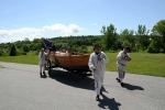
On flat terrain it was easy to go fast to the point where we were in danger of losing control. We proceeded down the public roads, along Rogers Street, then across a bridge over La Chute on Elk Road. We were almost running here, which wasn’t really desirable. We slowed down as we came to Montcalm Street.
We paused before the traffic light, then turned the corner and pulled the boat halfway down the block, stopping in front of the hardware store. Bill W. had departed briefly, and now had returned and positioned his car so that it would help shield us from traffic. The local traffic was courteous, but it was still nice to have a safety escort.
We periodically changed positions, always with two people pulling and a person on each wheel. We usually had one person at the stern doing much of the steering and the sixth person helping push on one side or the other.
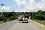
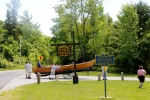
We turned on to Champlain Avenue. Here a long uphill stretch began, and we took frequent stops. It was never too much work, but it was definitely something of a chore. We stopped again in front of the sign for The Portage.
When pulling at the front, I found it most comfortable to sling the rope across one shoulder and my chest. When manning a wheel, I would push on the thole pins on the side of the boat, picking up or putting down the wheel chock as needed. When at the back, I would push directly against the stern of the boat.
We could have easily had 10 people moving the boat, but much more would not have been of any additional use (other than by taking turns). With more people, we could have gone faster, which isn’t necessarily a good thing.
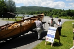
Bill W.’s wife, Ann, and his daughter, Lisa, joined us near what I think is a firehouse just beyond the park at the point of Champlain Avenue and The Portage. They brought nice cold water. We had enough drinking water in the boat, but cold water was most welcome. Heather came and went with our dog Monty, taking short videos of the portage.
After quite some time we had made it to the height of land. We paused for a snack of watermelon and almonds. Very tasty after sweating up hill.
Lake George is approximately 319 feet above sea level, and Lake Champlain is approximately 100 feet above sea level. Lake Champlain varies depending on weather much more than Lake George. I think that based on having traversed the route several times, our actual climb was more like 260 or 270 feet (and, thus, our descent was a total of 40 or 50 feet).
As we started down, I was a bit cautious. I didn’t know how the boat would handle. We took due (or perhaps excessive) precautions. Two people were on the tail ropes of the wagon, and we made sure we didn’t go too quickly. It would have been easy to go fast, but I’m not sure it would have been easy to stop gracefully.
We took another rest at the end of The Portage as we turned on to Black Point Road. Along the way numerous people had stopped to talk to us or just to stare. Many of them talked with Bill W., as he seemed to know everyone.
We had people sitting in lawn chairs to watch us go by, people mowing their lawns wave to us, and people walk up to us to ask questions. One fellow told us about transporting a large passenger ship from Lake Champlain to Lake George. It took three days with modern equipment, and, at one point, the trailer got hogged on one of the rolling hills.
We had made up a brief flyer explaining some of what we were doing. Heather had gotten 100 of them printed, and we gave out perhaps 70 of them throughout the day.
The Black Point Road is a series of small hills. Lake George is easily visible on the west side (our right), but the boat launch is a half mile from where we first saw the lake. Historically, the lake was a series of riffles at this point, but a dam now keeps the northern end at a single level.
We were mildly concerned about a large tractor-trailer, but the driver passed us without incident.
We turned in to the Mossy Point boat launch area. I think it was around 1 p.m., and we had taken roughly 3 hours to portage 2.5 miles. Heather and Bill W. both departed.
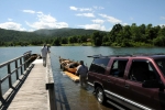
DEC has some people at various boat launches acting as Lake Stewards. They attempt to reduce the transport of certain invasive species. We stopped in front of the stewards’ table and let the pleasant woman inspect our boat. She found a strand of millfoil on the wagon which I had observed get stuck on when we were pulling the boat out of La Chute.
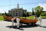
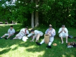
We relaunched the Bobbie G. It went in very smoothly. We then took a nice break and ate a late lunch on the grass.
After lunch we launched the DeSager. We then gradually sorted out all of our gear into the two boats. We rigged the sails, with the new lug sail in the larger Bobbie G and the old square sail in the smaller DeSager. After what seemed like a huge amount of time, we were ready to set off.
A power boat arrived with Bill W., Ann, and Lisa. As before, Bill took photographs of some of our activities.
We set out under oars, with Rick, Sam, and myself in the Bobbie G, and Reb, Bill M., and Kevin in the DeSager. Sometime between the rain storm of yesterday afternoon and the end of today’s portage, the wind had shifted. We now had light northerlies. We had only rowed a short way when we hoisted sail and stopped rowing. A delightful break from the labors of the day.
Soon afterwards, Bill W. and company motored off.
We mostly sailed the three miles to Roger’s Rock. A pleasant idyll, though I did lose my old mangy hat to a sudden gust of wind. Once we got opposite of the main cliff face of Roger’s Rock, the wind became fluky and we resumed rowing. We rowed in toward the campground.
It had been months since I had been there, and I couldn’t quite remember where the exact campsite I had reserved was located. For some reason, I remembered it being two spaces north of the beach, when it was actually two spaces south. We pulled up to the dock next to the boat launch, and I got out and wandered around until I found our camp site.
We rowed the boats over to the shore, then hauled all of our gear up from the shore to the flat area of the site. When the weather is fine, it always seems like we have an excessive amount of gear. When the weather is nasty we tend to use all of it.
Shortly after we arrived, Tim appeared. He will be joining us for the rest of the row. I went off with him to check in. Check-in at New York campgrounds is a tedious affair — they ask a great many questions, most of which have absurd answers when one has arrived by wooden boat. Since Tim had a arrived with a car, the questions were actually less absurd.
Kevin made a fine dinner which we ate hungrily.
We float the wagon, then slide the bateau on to it. We try to chock the wheels while they are underwater, but the chocks float too well. We finish sliding the bateau on the wagon
We managed to pull the bateau out of the water.
We work the wagon up over a big step at the bottom of the boat ramp, then start dragging the wagon up hill.
We pull the wagon up the first hill.
We move the bateau through a garden. We are still bow-heavy, making it harder than it needs to be
Moving along the street
Coming up The Portage
A long sequence as we approach the height of land
A long sequence down hill
Mossy Point
Thursday, 14 June 2012 – Rogers Rock to Bolton Landing
A fine, glorious day.
We got up and had a breakfast of salt beef hash and eggs. Ann arrived to join us for the day. We left her car having informed the campground that she would pick it up in the evening. Ann loaned me her hat, but it didn’t fit as well as my own, so mostly I wore a bandana today.
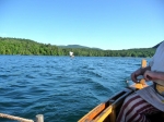
We laboriously struck camp and reloaded the boats. Our crew is made up of eight today, with Sam, Ann, Rick, and myself in the Bobbie G, and Kevin, Bill M., Reb, and Tim in the DeSager. We got under oars around 8:30. The wind was coming from the north and promised to be useful. Indeed, almost as soon as we were under way, we were able to set sail.
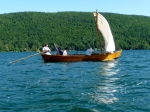
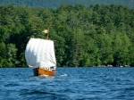
The wind was fairly steady and in a perfect direction. We were making very good time. The new lug sail is larger than the old square sail, and, therefore, in a friendly wind it tends to be more powerful. As such, the Bobbie G gradually overtook and passed the DeSager.
The wind freshened some, but not so much as to make sailing hard. We made superlative time. We passed the Waltonian Islands around half an hour after we started. This group includes Temple Island, where we had camped several years ago.
We sped up the North Basin, with only modest work on the steering oar and whisker boom to keep our course. We somewhat favored the western side of the lake, though this early in a weekday, we essentially had all of the lake to ourselves.
An hour more got us to Silver Bay. We were surprised at how quickly we were travelling, as usually it is far more work. Even when going quickly, steering is usually more difficult.
As we passed Sabbath Day point, the two boats were some distance apart. Based on our speed, we were going to reach our planned camping spot before noon. I suspected that we would decide to continue on, but we had to inform Heather, since she was planning on picking up Sam and Ann at Huletts Landing.
I steered the Bobbie G just east of south so as to head towards the landing. We were far enough away from the DeSager that we couldn’t speak to them to tell them why I was so directing our course. For a short while, they continued to parallel the western shore, which, since the lake trends towards the southwest, led them more westerly than our bearing. Eventually they came about and ended up rowing to meet up with us.
As we approached Huletts Landing, we dowsed sail. I could clearly see the beach where we had arranged to drop Ann and Sam. It was just past 11. When the DeSager came up with us, we discussed how the wind was perfect and we should continue on to Bolton Landing, not wasting such delightful sailing conditions.
We agreed to lunch on the island that we had planned to camp upon.
I needed to contact Heather to let her know of the change in plans. My cell phone service is very spotty on the Lake, but I knew that there was a zone of access vaguely between Huletts Island and Burgess Island. As I was fooling with the phone, trying to contact her, a small power boat came motoring toward us. To my surprise, it was Heather, along with her brother Scott, his wife Andrea, and baby Trevor. The communications issue was solved.
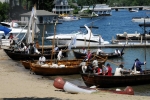
We rowed to Burgess Island, hugging the eastern side until we had wrapped around it to the dock designated for the campsite I had reserved. We docked our two boats plus the power boat. The water was clear and inviting.
Lunch was much the same as previous days — an assortment of meat, cheese, apples, and bread. We mostly sat on a delightful rocky outcropping. Some of the crew swam in the cool refreshing water. The crew from the power boat joined us — I hope that their modern inclusion didn’t intrude on our crew’s 18th century experience too much.
After lunch, we returned to the boats. As soon as we were out of the lee of the island, we hoisted sail. Heather took some video from the power boat, then they roared off to return the boat to the rental agency where they had started.
The sailing after lunch was just as fine as that of the morning. We made excellent time and had a relatively easy time on the steering oar and whisker boom. The Bobbie G continued to be slightly faster than the DeSager, all of which I attribute to sail area. In lighter airs, DeSager was a bit faster. I’m interested in how the sails will differ on a beam wind, but we won’t learn that today.
We slid quickly by the Mother Bunch Island. This section of the lake is absolutely beautiful, without much development, and not a lot of boat traffic.
An hour later we entered the Narrows. We started in the central channel between Little Harbor Island and Fork Island. The islands blanketed our sails some, but we always had enough way that we didn’t need to row. After passing to the south of Mohican Island, we turned slightly and passed Oahu Island to the north. From here we could see Crown Island and Green Island just beyond it. We steered straight for the southern point of Green Island.
Once passed the Narrows the wind freshened slightly, but was by no means overpowering. The Bobbie G increased her lead on the DeSager. Another 45 minutes and we saw the Sagamore Hotel with its elaborate waterfront chairs, docks, and patios. We dowsed sail so as to wait for the DeSager, which came up in ten or fifteen minutes.
We ended up rowing from here, as the winds were fluky in the lee of Green Island. As soon as we had rowed by the Sagamore we could see the public docks at Rogers Memorial Park.
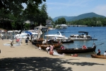
As we rowed to the park, we finally started seeing a significant number of other boats. We navigated around them and pulled in to the docks, tying up around 2:30. We had covered 21 miles in around six hours or so, including a stop for lunch.
We started unloading the boats, lugging all of our seemingly excessive gear to the grassy area just on the far side of the parking lot.
A short time after we arrived, Heather showed up. After a brief while, Heather took Sam, Ann, Tim, and Rick to Rogers Rock campground. From there, Sam and Ann left, as they both had places to be on Friday. Tim gave Rick a ride to his truck at Ticonderoga Ferry.
I’ll add a big thank you to Sam for joining our adventure. He was a good man to have on the crew.
In the mean time, we finished unloading the boats and setting up camp. By dinner time, everyone (except Sam and Ann) had returned from various errands to the camp.
We went out to dinner at a local restaurant, the Lakeside Lodge. They wisely put us on the patio, as, having been working outdoors for the last three days, we really didn’t want to be in an enclosed space. We had an excellent meal, and not just because exercise is the best sauce.
Eventually, we all turned in for the evening. A superlative day.
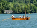
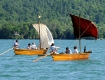
Sailing
Setting sail after lunch
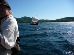
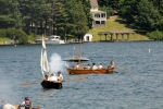
The two boats under sail
Friday, 15 June 2012 – Rest Day
Today was a relaxing rest day. Often at the end of the rowing portion of the trip, we go right into a reenactment, and the crew has almost no energy for the various activities. With yesterday’s delightful sailing, we now have a rest day.
Today the wind was calm, which made us very glad that we had sailed all the way yesterday. Certainly, Burgess Island would have made a lovely campsite, but it is much nicer to be at our destination and not rowing.
In the morning, Heather drove the remaining drivers to their various cars. Reb and Kevin were delivered to Ticonderoga Ferry, and I was brought to Mossy Point. We drove back, got the boat trailers parked at the Norwhal Marina, and then went back to camp.
We reassembled the boat wagon in front of our camp. It makes an excellent display. At some point, Bill and Ann Westervelt from Ticonderoga showed up. They are helping with the event, especially at the registration for reenactors. Bill had printed out a few pictures he took of us on the portage. We hung these on the boat wagon, which let passersby see what we had done.
Otherwise, this was a very easy day. We ate lavish meals. We rested. We sorted gear.
We bought some axle grease for the boat trailer, as the axle was as dry as if I had never greased it at the end of the portage. I had packed the axle with quite a lot of grease before we started, and was surprised at how virtually none of it remained.
We also had unloaded the boards for tomorrow’s pontoon project.
Saturday, 16 June 2012 – Pontoon and Bolton Landing Reenactment
We started the day with breakfast at a local diner, which was pleasant and good. After a dawdling start, we got to work.
Historically, the French army transported their heavier artillery up the lake by placing each piece of a platform built between two bateaux. I quote from Adventure in the Wilderness: The American Journals of Louis Antoine de Bougainville:
Among the artillery bateaux are thirty-one pontoons made of two bateaux fastened together with a platform on top. These pontoons carry the cannon and mortars, mounted on their carriages. They are very well conceived for a lake with high shores like Lake St. Sacrement.
We wanted to try this ourselves. My assumptions were that the pontoon would be most unwieldy. We ended up using Ken Schultz’s (Herkimer’s) cannon as it was the only cannon present.
I had brought a collection of 2×8 and 2×10 boards of various lengths, some 14 feet and some 10 feet in length. We brought each bateau off of the dock, and rowed it to the beach. We landed the two bateaux side by each with their bows resting on the sandy beach.
The beach was filled with locals and tourists swimming in the beautiful waters of Lake George. Fortunately, the beach wasn’t too crowded, and the swimmers gave us ample room to do what we were doing without either group being too inconvenienced by the other.
We started by lashing two long boards across both boats. These were 14 foot long 2x8s. One was placed just aft of where the mast thwarts are located, and the other was placed about 8 feet aft of this. The two boards were adjusted so that the center line of the two bateaux were parallel. The two boats had a gap of a few feet between them at their closest point.
Each board was lashed in four spots — a lashing at each gunwale of each boat. This constrained the two boats to prevent them from tilting underneath the boards. We used some strange-smelling cord that Bill M. had obtained to do the lashing. It wasn’t super strong, wasn’t very flexible, and was annoying to work with. However, it had the virtue that we had a lot of it and we didn’t mind if we would have to cut it later.
After lashing the two cross boards to affix the bateaux together, we lashed on three shorter (10 foot, 2×10) boards lengthwise along the bateaux. These were lashed on top of and perpendicular to the cross boards that had already been added. I originally envisioned using four of these boards, but ended up only using three. The outer two boards were spaced so that the wheels of the cannon rested on the center of the boards. One trail of the cannon was also on one of these boards. The third board was positioned so that the other trail of the cannon was on it. I had thought that we might need a fourth board to support the cannon, but it proved not to be necessary.
After lashing all of the boards together, we used two more of the 14 foot boards as ramps. We wheeled the cannon down to the beach, over the sand, and up the ramps, with the muzzle of the cannon pointing in the same direction as the bows of the boats. We placed the wheel chocks beneath the cannon wheels, then lashed the cannon wheels and trails to the boards using the easier-to-handle breast mooring lines.
After loading the cannon we started adding some further security to the rig by using the remaining mooring lines to lash the two boats together. Scott Padeni made the valuable suggestion of adding scissor lines to the whole affair to tighten it up. These are lines running from the bow of one boat to the stern of the opposite boat. In addition to these, we ran a line between the two bows and a line between the two sterns. These lines we secured by using the thole pins as bitts.
All of the crew helped, and by the time we were finished the rigging we had quite the gaggle of onlookers. I was glad it was a beautiful day, as I ended up wading alongside the boats for much of it, including ducking under the platform we had constructed.
After having everyone take a break, we gathered the crew. Kevin manned the steering oar of the Bobbie G, and I manned the steering oar of the DeSager. We had four rowers, Bill M., Rick, Raoul, and Ann, with two in each boat. In addition I had T in the Bobbie G to help keep an eye on the cannon, and, as always, Reb was our bows.
Not being sure how things would work, we planned only a short trip. After clambering aboard, we pushed off. Heather managed to get some video of the trip. The boats gliding away from the beach, and Kevin and I worked in concert to turn the bows around to face the lake.
The rowers let fall and began to row. Much to my pleasant surprise, the entire contrivance behaved as a single vessel. There was a very small amount of flex in the boards and lashings, but the whole was solid and sound. As the rowers pulled, the combined craft worked beautifully.
We crossed the swim bouys around the beach, saw Ken watching his cannon from the dock like a nervous father, and headed into the lake. The modest waves on the lake from various boat wakes caused the pontoon to flex a bit, but the whole system remained rigid and sound.
It took the rowers a little bit to find their rhythm, as they were working separate boats, but they soon fell into sync. Steering was best as a joint activity between the two coxswains. We only went out until we could feel the bigger waves from the wakes and get to the first buoy marking the reduced-speed zone around Bolton Landing. We circled the buoy and headed back.
The short trip back was glorious. I am confident that such a pontoon is nearly as efficient as a single boat. It requires more crew and more coordination, but it is not the hardship to maneuver or row that I expected.
We landed on the beach, and our fellow sailors gave us a nice round of applause. After a short while, we unloaded the cannon, which went very smoothly. The platform was astonishingly stable. Someone asked how solid it was, and I jumped a bit on it to show that it was sound. I can’t imagine a much sounder platform, even if it was a deck of a single vessel.
At the time, I was a bit nervous about the entire project, but in retrospect I wish we had left things lashed together longer. I had some people ask why we didn’t make a bigger affair of it for the public. As we had never done it before, I really didn’t know how well it (or we) would work, and didn’t want a big crowd to see a tedious project or a disaster.
We gradually disassembled the rig, and the crew dispersed for lunch.
After lunch we did a mock battle reeactment with the various boats that were present portraying a French flotilla landing against a British force and then being driven off again. This went well, and I thought it looked pretty good considering the small piece of terrain we had to work in. One virtue of being in a town park is that many more of the public saw the reenactment than would normally, as they happened across it by accident.
Since we had a nice rest day yesterday, in the evening we had enough energy that many people went to a dance held on the wharf. It is unusual at the end of a Big Row for us to have any energy to spare.
This was a reeactment that was officially sanctioned by ASMA (the Age of Sail Maritime Alliance). At each of their sanctioned events they award an “onion bottle” (referring to the shape) of rum to the unit that they think has brought the best impression or the biggest contribution to the event. This evening, we were awarded the onion bottle. I must say that the recognition of one’s peers is more gratifying than almost anything else. I am delighted that our crew is so willing to try different tasks — portages, rowing trips, pontoons, different sails. A fantastic day.
Rick had to depart, and we sent the DeSager with him.
Lashing a plank
Placing the third plank
Loading the cannon, removing the ramps, chocking the wheels
Pushing off and rowing out
Pontoon turning and starting back
Pontoon returning to the beach
Sunday, 17 June 2012
Another lovely day. We did another reenactment today, but nothing out of the ordinary. We expressed great thanks to Bolton Landing for putting on such a nice reenactment.
After the reenactment, we rowed over to the Norwhal Marina, loaded the Bobbie G on the trailer, and went back to the camp to strike our tents. An excellent trip.
