Also known as ‘The Big Row, 2013’
Photos were taken by Bill Manthey, Kevin Richard-Morrow, and Ann Thomas. The photographs are copyright by the person who took them. Text is by myself, David Manthey.
Monday, 26 August 2013 – Indian Ridge Campground, Athens
I start this account with a sincere thank you to all of the rowers and helpers for the Big Row. We ended early due to a personal crisis, and I am grateful that the rowers were so accommodating.
This rowing trip was originally going to end at Constitution Island. There was going to be a Revolutionary War reenactment there on August 31 and September 1. Since the tides lined up so well, this became the reason and destination of this year’s row.
However, the Constitution Island reenactment ended up first being moved in time, then cancelled. Since the tides were still favorable and we had already begun planning, we continued with the schedule to travel down the Hudson River. Other options were explored, but none panned out.
Ultimately, I hoped that we could get to Croton Point by Friday afternoon, and then take out in Ossining on Saturday. This was an ambitious plan – 85.5 miles in four days. Although the tides were favorable, this was still averaging more than 20 miles a day. If the winds are fair or we have an excess of crew, this can be accomplished. If the winds are foul, this is nearly hopeless.
There was also doubt about running one or two bateaux this year. Some rowers only confirmed shortly before the start, but still soon enough that we could commit to two boats. Rick R. was gracious enough to lend us his truck so that I could tow the second boat. On Sunday, Ann, Rick, and myself rowed the DeSager from the Mabee Farm to the Rotterdam boat launch and took the boat out on the flatbed trailer.
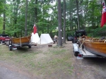
Kevin and I met at the Farm. Using Kevin’s Jeep and Rick’s truck, we hooked up the two trailers with the two boats. We towed the boats to a campground near the starting point in Athens.
This was Indian Ridge Campground, a pleasant campground with lots of RV and a few tent sites. I had reserved two tent sites, as I hadn’t known how many people I would have camping on Monday night. We had a total of five people for the evening; three more rowers would join us on Tuesday morning.
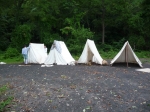
The tent sites were relatively hard, dusty ground. We pitched our tents, made a simple dinner, and did a little preparation for the next day. It started to rain, and we retired just a little after 8 p.m.
Tuesday, 27 August 2013 – Turkey Point, near Glasco
It rained very hard over night. The forecast had been for intermittent showers, but the rain was fairly continuous and quite hard. The dusty ground splashed mud and dirt all over the tents. The hard ground pooled water, and one of the rowers retired to a dry vehicle for the night.
We cooked a breakfast of eggs and bacon, struck our wet and dirty camp, then departed the campground around 8 a.m. A five mile drive brought us to the starting location, the boat launch in Athens, New York.
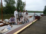
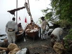
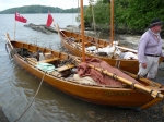
We launched both boats, the Bobbie G and the DeSager. We loaded all of the gear in the boats. We started with eight rowers: Kevin, Reb, Bill, Peggy, Pete, Ann, Dave Mi., and myself. Peggy’s husband, Jack, took a picture of the group as we were ready to set out.
While we were getting ready, we managed to break a thole pin in the DeSager. This was a little surprising as in over ten years this is only the third thole pin that has failed. We use the forward-most thole pins as back-ups for the others, as we never use the rowing station before the mast. However, the heavy rains of the previous night had swollen the wood, and I found it too difficult to extract the broken thole pin or any of the spares. For the moment, the DeSager can’t row from one station on one side.
Time and tide do not wait. We managed to get underway around 9:30, just as the tidal current started to ebb. One of properties of the tide that people find surprising is that the beginning of the ebb current does not correspond with high tide, nor the beginning of the flood with low tide. Rather, the ebb lags high tide (at least here on the Hudson River) by about an hour, and the flood lags low tide a similar amount.
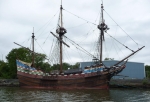
We rowed out of Murderer’s Creek (the small creek that the Athens Boat Launch is on) and into the Hudson River. Just a short distance downstream we passed Peckham Wharf where the Half Moon was tied up. Kevin called to her with his speaking trumpet, but there was no response – either there was no one aboard or they were all below decks.
We started off rowing. The day had started dim and overcast. The cloud cover is quite nice, as it is easy to get overheated while pulling on the oars. We rowed passed the town of Athens, including the lovely town park.
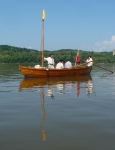
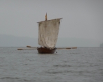
I had put up the masts and rigged the halyards and pennants through the deadeyes, but not unfurled the sails nor rigged out the brace and sheet lines. After we were a mile south of Athens, a light northerly breeze began to blow intermittently. Reb and I agreed it was time to set sail, so we unfurled the sail, ran the braces and sheets to their respective cleats, and hoisted away. A light breeze and a ebbing tide are a wonderful thing.
After we had the sail up, we had morning rum call. New rowers are often surprised by a morning rum call – they feel it is too early for rum. We aren’t issuing enough for people to get drunk, but it does help loosen the muscles and makes people cheerful. Also, we usually accompany rum call with cookies.
Reb operated the whisker boom to help shape the sail. The DeSager dropped back a bit. It has a smaller sail than the Bobbie G, and, we fancy, Reb has more experience on the whisker boom than any other crew member. The whisker boom, properly held, helps control the sail and steer the boat.
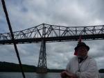
The winds continued light and a little fluky, but quite usable. We sailed underneath the Rip Van Winkle Bridge.
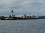
Throughout the day we passed many barges and tugboats. Some barges are obviously petroleum barges, some full and some empty. These seem to usually have a single barge per tugboat. Others barges contain gravel or other building materials. These are often rafted together with as many as eight barges to a single tug.
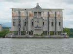
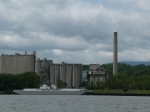
There are quite a number of cement plants along the river. There are tall silo-like storage containers right on the river, often with a conveyor system to shunt the various ingredients between the river front and the main factory.
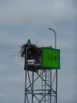
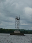
There are several lighthouses along the Hudson. The first marks the southern end of Middle Ground Flats, the island and shoals between Athens and the town of Hudson. It is a pleasant square building.
Several years ago we had camped at the park on the north side of Catskill Creek, Dutchman’s Landing Park. This is a large, open park with a nice boat launch. We continued on, rowing some and sailing more.
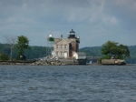
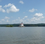
Because of the wind and tide, we made decent time. We covered the distance between Catskill and Saugerties relatively quickly. Saugerties has the second lighthouse along the Hudson, marking the point where Esopus Creek empties into the river.
As we approached Saugerties, we could see odd forms near the base of the lighthouse. At low tide, the base of the lighthouse is exposed. A family was playing on the rocks, and their distant forms were what we had seen.
A mile and a half south of Saugerties we rowed in to the town park in Glasco. This park has two boat ramps. We had stopped for a natural break at the northern one years ago, and, as it is intended for hand-launch vehicles only, it has no dock. The river bottom shoals out close to shore, so any wake tends to get magnified here.
The second ramp has a nice dock along side it. We stopped to let off Ann, who could only join us for the day. Heather had driven to Glasco to pick her up and take her back to her vehicle. The rest of us took a natural break and talked with some of the people who were enjoying the park. We also swapped out thole pins so that we could row in all stations again.
Another two miles brought us to our camp site for the evening. Turkey Point is now part of a state forest. It had been an industrial dock at one time, and still has a battered concrete apron with an old gantry on it. There is an area to pull the boats up on the south side of the point. This wasn’t particularly practicable at low tide, so we secured the boats a few dozen feet further along the bank.
We unloaded our gear. Although Turkey Point is designated as part of the Hudson River Water Trail, and is rated for camping, it is not a great spot. The only level area of any size is a brown-pack parking lot at the end of a long dirt road. This is, somewhat ludicrously, marked with handicap signs in spots. The road heads off up hill. I’ve never walked the whole thing, so don’t know where it connects to paved roads.
I had hoped there would be an obvious trail to Ulster Landing and the privies there, but there is not.
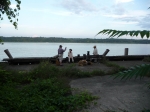
We pitched our tents on the brown pack. Kevin organized and made dinner out on the concrete apron with a fine view of the Hudson. We had a lovely meal, and we all are hungrily.
Total distance today, around 20.5 miles.
Wednesday, 28 August 2013 – Esopus Island
Today we have our lightest crew, as Ann departed last night and we wouldn’t get anyone else to join us until tomorrow. Today was also our short day, so I wasn’t concerned about the crew being able to make our distance..
We ate breakfast. With the tide in, we were able to bring the boats closer to the campsite. We struck camp, cleaning off the brown-pack from our gear as best we could, and loaded up the boats.
There was some light wind in the morning, but most of today was rowing. The forecast had called for northerlies, but they didn’t materialize, and by the end of the day we had some southerlies. There wasn’t much shade today, either, so over the course of the day we started to feel fairly cooked.
We had a brief stop after two miles at Ulster Landing Park. Being the middle of the week, the only people visible were some park workers.
There were a few barges today, but not as many as yesterday.
We passed under the Kingston-Rhinecliff bridge without any fuss. The last time we rowed down the Hudson, we had this bridge visible for something like 17 miles of a very long day, and it never seemed to get any bigger. With the stop at Turkey Point, we weren’t much concerned by the bridge and going under it would have hardly been worth a mention had it not been for the contrast from the previous trip.
As one approaches Kingston, there are more cement factory silos. Just north of Kingston there is a town park with a dirty sand beach. We had ended a trip at this location, and were thankful not to be camping here.
Kingston is a mile or so up Rondout Creek. At the mouth of the creek is a well-kept lighthouse. It feels like one has to row quite far out into the river to get by this lighthouse, but the area between it and the marked shore is very shallow and has a line of palisades to attempt to keep the channel clear.
The south side of the creek opens on a wide shallow bay, much covered in devil weed. Because of shipping, it seems like it would be a good idea to sidle over to the western bank, but the devil weed is far more trouble than it is worth.
The Hudson changes direct from just west of south to south-southeast. This leg is only a few miles long, but in the hot sun it seemed much further. The tide was assisting us today, but not as much as I had hoped.
We had a brief stop near Esopus Meadows. Almost as soon as we had relaunched we could see Esopus Island, which is our camping site for tonight.
On the eastern shore we passed the high bluffs of Mills-Norrie State Park. There is a pleasant marina at this park, but the campsites are quite a ways from the water.
We reached the northern end of Esopus Island. I had only reconnoitered the island quite a while ago, so I had not remembered what facilities it had. A picnic table on the clearing at the north end showed that we were at our campsite for the evening. It was only early afternoon.
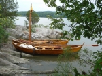
There was an excellent small cove surrounded by rocks. The tow boats fit perfectly in this cove side-by-each, almost like a submarine pen for them. We tied up the boats and took a much needed shade and shrub break.
We slowly unloaded the boats and set up our tents. The island is nicely wooded with a pleasant path running along its spine. There are a few higher clearings, quite a number of small rocky cliffs, and pleasant views all around.
Kevin again made dinner, this time a tongue stew. Most of the crew enjoyed it, and he provided some ordinary beef for those who didn’t care for it.
After getting to this island, I checked my phone messages. I had an urgent personal message that turned out to be a family tragedy. I was quite torn on how to disclose my distress, and not certain how to proceed. I talked things over with Kevin; I needed to be back in the modern world to take care of things on Friday. Everyone was having a lovely evening, chatting and singing and enjoying the beautiful night. I decided to tell everyone in the morning.
With a heavy heart, but pleased that my friends and crew were having a good time, I retired for the night.
Distance travelled today, about 14 miles. Total distance so far, about 34.5 miles.
Thursday, 29 August 2013 – Beacon
This morning we got up and started making breakfast. I called the crew together and told them that I had a personal emergency, and I would need to leave this evening. The rest of the crew could have continued on. On the plus side, I had planned out a campsite on Denning Point, and the ending site at Croton was a nice campsite. On the minus side, they would have a light crew, the campsite at Denning Point is very rough, and the wind forecast for Friday was strong southerlies.
The crew graciously decided that we should end tonight. Since were weren’t planning on reaching a reenactment, this didn’t cause any issue. I don’t think anyone was particularly disappointed, but I’m not certain. David Mi. had to depart at the end of today in any case.
We were still going to pick up another rower today. Cynthia was joining us at Norrie Point, which would necessitate one boat backtracking around a half mile to get her.
We ate breakfast and packed up the boats. We sent DeSager with a crew of three down river, while the Bobbie G with a crew of four rowed to Norrie Point.
At the southern end of the point is the Norrie Point Environmental Education Center, a pleasant-looking building. A light rain was falling as we approached the center’s dock. Cynthia and another woman came out of the building, Cynthia carrying some jugs of water that I had asked her to bring.
The other woman turned out to work at the environmental center. She let us fill up our 5-gallon water jugs that we carry with us on the boat. This, combined with the water that Cynthia brought ensured that we would have enough water for the rest of the trip, regardless of circumstances. We talked with a few other people at the center and explained our unusual clothes and boat.
We pushed off after a stop of 20 minutes or so. DeSager was already at the far end of Esopus Island. With five crew, we gradually gained on them.
The Hudson is fairly straight here. We worked our way south, the tide and a light wind giving us an assist. The light rain continued. When Bobbie G caught up with the DeSager, we transferred Reb over to the DeSager, evening up the crews. The rain reduced to a fine mist, which was pleasant after yesterday’s sun.
The Poughkeepsie bridges came into view. The first was originally a railroad bridge and is now a foot bridge – the “walkway over the Hudson”. The second is for automotive traffic. Before we reached the bridges, we passed Marist College’s boathouse. This was the site of the 2007 piracy incident, where two men in a rowboat attempted to make off with the DeSager around midnight.
We passed under the bridges, and the weather had moderate to just having heavy clouds. The wind gradually died away.
The Hudson is not quite as uniform and straight south of Poughkeepsie. It widens out, narrows, widens further, narrows, and so on. The rowing was pleasant.
The fifteen miles between Poughkeepsie and Beacon went by in the usual manner. Row. Switch rowers and steersman. Row. Rum call and cookie break. Row. Lunch. Row. Switch. Row. A delightful day. The two boats stayed close to each the whole trip.
As we approached Beacon, we became eager to arrive. Even though we would be ending the trip a day early, I don’t think anyone in the crew particularly minded. We had no reenactment to get to, so the ending was going to be anticlimactic in any case. Plus, after camping at Turkey Point and hearing my description of the rough ground at Denning Point, I don’t think the crew was particularly eager to spend the night there.
We passed under the Beacon-Newburgh bridge, came out past the small point of land at the Beacon waterfront, and headed in to the boat launch. The dock looked the worse for wear, but it was still sufficient to tie up both boats. Heather was waiting at the launch for us.
Total distance today, around 23.5 miles. Total distance for the trip, around 58 miles.
Now came the long process of unloading the boats and dispersing belongings to each person, getting people back to their vehicles, getting the boats on trailers, and taking the boats back to the farm. Jack showed up to get Peggy and help Cynthia get back to her car. Heather took a pile of us to get vehicles left at Athens. We talked with various commuters using the Beacon train station, a fellow at the local yacht club, and a variety of other people.
Sometime after midnight, Kevin and I returned the boats to the farmyard. This got me home in time to deal with my unpleasant business the next day. Aside from the early end, a decent trip.
